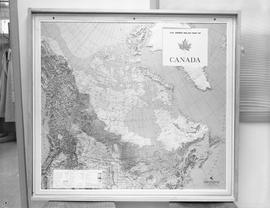
Map of Canada
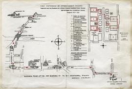
BCVS Campus Map for First Conference on Apprenticeship Training October 4-5, 1962
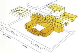
BCIT Map from Official Opening Brochure
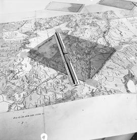
School Programs; Forestry Technology - 1967, map and rulers
Forestry Technology - 1967, map, aerial photograph
The B.C.I.T. and B.C.V.S. Parking Problem
The B.C.I.T. and B.C.V.S. Parking Problem
![Navigation, 1968; five men standing at a table examining a navigation chart [2 of 3]](/uploads/r/null/1/0/1/10182deb179889e76920e1c2749ea37f7be4cb511535b7b0616ec0ee4f62b0b9/a004370_142.jpg)
Navigation, 1968; five men standing at a table examining a navigation chart [2 of 3]
![Navigation, 1968; five men standing at a table examining a navigation chart [1 of 3]](/uploads/r/null/8/5/2/852ed62941c0c1f11d3b983f502272b3b510a278931d5896da0c869de2e55e8b/a004369_142.jpg)
Navigation, 1968; five men standing at a table examining a navigation chart [1 of 3]
![Navigation, 1968; five men standing at a table examining a navigation chart [3 of 3]](/uploads/r/null/8/b/a/8ba9fc386cdf71826b464fa89876f24580bd7fba57a838e733d316fb60c96c64/a004371_142.jpg)
Navigation, 1968; five men standing at a table examining a navigation chart [3 of 3]
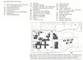
Handbook of Facilities and Procedures
Handbook of Facilities and Procedures
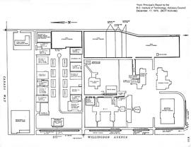
BCIT campus map, December 17, 1970
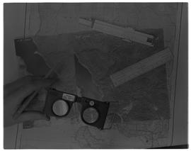
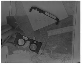
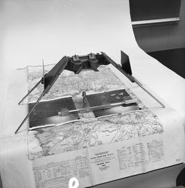
BCIT Programs Forestry Technology ; map and a stereoscope
![BCIT Programs Forestry Technology ; dot measuring ruler and a map [1 of 2]](/uploads/r/null/b/5/9/b596ffa6c759d7f93b569cac5006b0514f8031349695369034880523f3289206/a003061_142.jpg)
BCIT Programs Forestry Technology ; dot measuring ruler and a map [1 of 2]
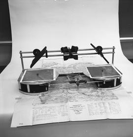
BCIT Programs Forestry Technology ; radial planimetric plotter, magnifying glass , map
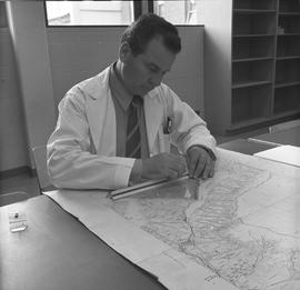
BCIT Programs Forestry Technology ; man measuring distance on a map using a ruler
![BCIT Programs Forestry Technology ; measuring equipment and a map [2 of 2]](/uploads/r/null/f/6/2/f62f88833e712587154b820fcea66793d68932913359a5b897b2b94eaf6f225f/a003080_142.jpg)
BCIT Programs Forestry Technology ; measuring equipment and a map [2 of 2]
BCIT Programs Forestry Technology ; side view of map, areameter grid and ruler
![BCIT Programs Forestry Technology ; map, areameter grid and ruler [2 of 2]](/uploads/r/null/d/a/d/dad1d1cb575a887952e6ba648a063637b7128fd33225d0d881bc0d7147538aa2/a003059_142.jpg)
BCIT Programs Forestry Technology ; map, areameter grid and ruler [2 of 2]
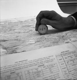
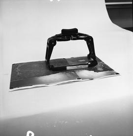
BCIT Programs Forestry Technology ; a map reader conversion tool being held on a map
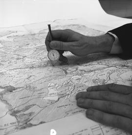
BCIT Programs Forestry Technology ; person demonstrating how to use a map reader conversion tool on a map
BCIT Programs Forestry Technology ; mirror stereoscope, aerial photos and map
The 1979-1980 guide to (almost) everything you've wanted to know [title cont. in note]
The 1979-1980 guide to (almost) everything you've wanted to know [title cont. in note]
Campus Sign Program map from BCIT Developments January 24, 1979
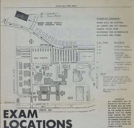
Campus Map from the Link Student Newspaper, May 2, 1979
Proposal for B.C.I.T. Staff Center
Proposal for B.C.I.T. Staff Center