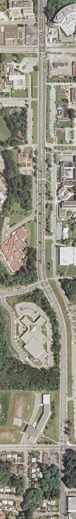
Orthophotograph of BCIT Burnaby west campus, Willingdon Avenue, 2005
- C23-a005950
- Item
- 2004
British Columbia Institute of Technology
Orthophotograph of BCIT Burnaby west campus, Willingdon Avenue, 2005
British Columbia Institute of Technology
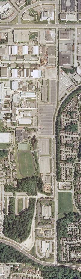
Orthophotograph of BCIT Burnaby east campus, 2004
British Columbia Institute of Technology
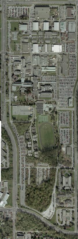
Orthophotograph of all of BCIT Burnaby campus, 2004
British Columbia Institute of Technology
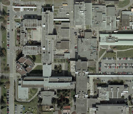
Orthophotograph of BCIT Burnaby campus SW and SE, 2004
British Columbia Institute of Technology
![E.L.I.T.E. '94 Exploring Alternatives [title cont. in note]](/uploads/r/null/e/9/2/e925a9a7143d2c526aef744a89c86bdff948b41b5bfe82be70a53de93c867045/C11-461_142.jpg)
E.L.I.T.E. '94 Exploring Alternatives [title cont. in note]
Part of BCIT Pamphlets collection
Part of Guichon Creek collection
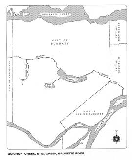
Guichon Creek, Still Creek, Brunette River, map
Part of Guichon Creek collection

Pamphlet Advertising the Construction of the Seymour Centre and BCIT Downtown Campus
Part of BCIT Pamphlets collection
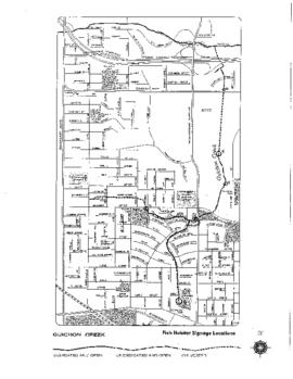
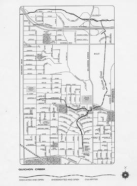
Guichon Creek Fish Habitat Signage Locations
Part of Guichon Creek collection
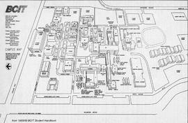
Campus Map from BCIT Student Handbook 1988-1989
Part of BCIT campus maps collection
British Columbia Institute of Technology
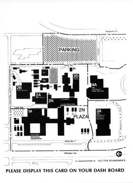
BCIT Rededication invitation card insert; please display this card on your dashboard
![BCIT Campus map ca. 1980s [poor quality]](/uploads/r/null/c/9/e/c9e382f9db128b3893b133f63a0887cd48fc844f1e7d877ffb1429538fdc0db5/CampusMap_old__142.jpg)
BCIT Campus map ca. 1980s [poor quality]
Part of BCIT campus maps collection
British Columbia Institute of Technology
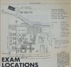
Campus Map from the Link Student Newspaper, May 2, 1979
Part of BCIT campus maps collection
British Columbia Institute of Technology
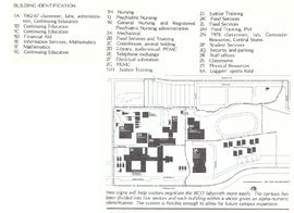
Campus Sign Program map from BCIT Developments January 24, 1979
Part of BCIT campus maps collection
British Columbia Institute of Technology
BCIT Programs Forestry Technology ; map and a stereoscope
British Columbia Institute of Technology
![BCIT Programs Forestry Technology ; dot measuring ruler and a map [1 of 2]](/uploads/r/null/b/5/9/b596ffa6c759d7f93b569cac5006b0514f8031349695369034880523f3289206/a003061_142.jpg)
BCIT Programs Forestry Technology ; dot measuring ruler and a map [1 of 2]
British Columbia Institute of Technology
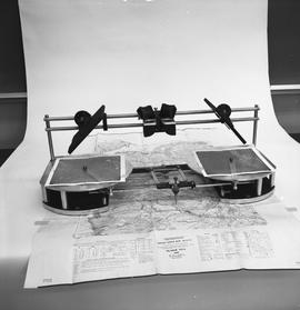
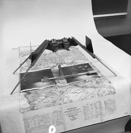
BCIT Programs Forestry Technology ; radial planimetric plotter, magnifying glass , map
British Columbia Institute of Technology
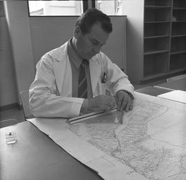
BCIT Programs Forestry Technology ; man measuring distance on a map using a ruler
British Columbia Institute of Technology
![BCIT Programs Forestry Technology ; measuring equipment and a map [2 of 2]](/uploads/r/null/f/6/2/f62f88833e712587154b820fcea66793d68932913359a5b897b2b94eaf6f225f/a003080_142.jpg)
BCIT Programs Forestry Technology ; measuring equipment and a map [2 of 2]
British Columbia Institute of Technology
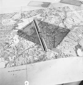
BCIT Programs Forestry Technology ; side view of map, areameter grid and ruler
British Columbia Institute of Technology
![BCIT Programs Forestry Technology ; map, areameter grid and ruler [2 of 2]](/uploads/r/null/d/a/d/dad1d1cb575a887952e6ba648a063637b7128fd33225d0d881bc0d7147538aa2/a003059_142.jpg)
BCIT Programs Forestry Technology ; map, areameter grid and ruler [2 of 2]
British Columbia Institute of Technology
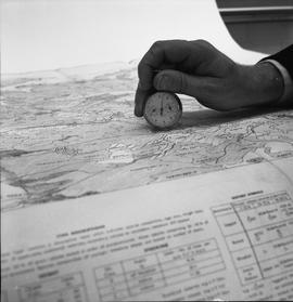
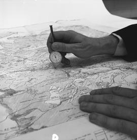
BCIT Programs Forestry Technology ; a map reader conversion tool being held on a map
British Columbia Institute of Technology
British Columbia Institute of Technology
BCIT Programs Forestry Technology ; mirror stereoscope, aerial photos and map
British Columbia Institute of Technology
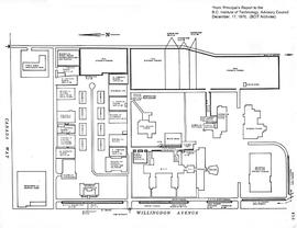
BCIT campus map, December 17, 1970
Part of BCIT campus maps collection
British Columbia Institute of Technology